A Smarter Perspective on Your Land
Gain detailed aerial imagery for crop monitoring, soil assessment, and facility inspections. Whether optimizing yields, documenting conditions for insurance, or managing storage sites, drone technology provides the insights you need.
Contact us learn how professional drones can benifit your farm!Drone Imaging
High-Resolution Drone Video
High Resolution Maps
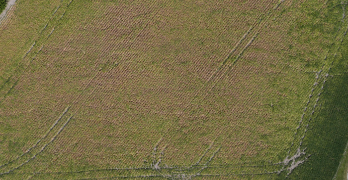
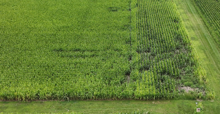
Plant Health NDVI Maps

Inspection Imagery
How Our Process Works
Each project with dbgDrones, Inc. is tailored to meet your specific needs. We begin by understanding your project requirements, then our remote pilots will recommend the most suitable flight options. Clients can choose the number of flights, flight schedules, and final deliverables. Common construction deliverables include aerial photos, video, and orthomosaic maps, with custom options also available. Projects can be purchased as packages.
Call us to schedule your flights now!One-time Flight
One-time flights provide a detailed snapshot of your farm or homestead for land assessment, infrastructure planning, and crop or soil evaluation. Ideal for pre-purchase surveys, disaster damage assessment, irrigation analysis, and farm marketing. Choose from high-resolution aerial imagery, orthomosaic maps, or video, customized to meet your specific agricultural needs. For urgent concerns like emerging pest issues, a single flight can quickly scan fields to pinpoint affected areas, helping you take immediate action before the problem spreads. These flights complement—rather than replace—an effective crop scouting program.
Milestone Flights
Milestone flights provide critical insights at key stages of your agricultural operations and infrastructure projects. Capture aerial imagery before planting to assess field conditions, monitor crop emergence, and track growth stages. Document key events like irrigation setup, fertilization cycles, and pest or disease treatments to evaluate effectiveness and improve planning. For farm expansions, storage facilities, or fertilizer plant construction, milestone flights help track progress, support project management, and provide valuable records for insurance and marketing. These flights work alongside traditional crop scouting methods to enhance decision-making and long-term planning.
Scheduled Progress Missions
Scheduled flights provide consistent, time-based monitoring of your farm, fields, or agricultural infrastructure. Whether flown weekly, biweekly, or monthly, these flights track crop progression, soil conditions, irrigation effectiveness, and seasonal changes. Regular imaging helps detect trends, identify emerging issues early, and optimize resource management. For infrastructure projects like storage facilities or fertilizer plants, scheduled flights document construction progress over time. While scheduled flights offer valuable long-term insights, they are designed to complement—not replace—an effective crop scouting program.